
The Johnson County Sheriff’s Office is creating a livestock map to protect animals / livestock in the event they escape their enclosure.
The livestock map is a completely voluntary form where you can enter your contact information and types of animals / livestock. This information is only accessible by the Johnson County Sheriff’s Office.
The Johnson County Sheriff’s Office says the livestock map is a simple way to keep your animals/livestock safe and reduce the chances of an accident occurring if they escape.
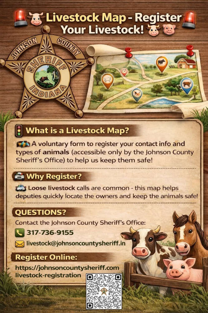
The Sheriff’s Office receives multiple calls a year regarding livestock that have gotten out on county roads. The livestock map would help our deputies locate the owners quickly and keep the animals safe.
Livestock registration link: https://johnsoncountysheriff.com/livestock-registration
You can contact the Johnson County Sheriff’s Office at 317-736-9155 or livestock@johnsoncountysheriff.in.gov
 Greensburg man killed in Ripley County crash
 Shelbyville man arrested following pursuit
 Class of 2027 graduates can apply for scholarships through Blue River Community Foundation
 Waldron Co-Salutatorian values the impact teachers can make on children
 Indianapolis Indians to celebrate 30 Years of Victory Field
 Waldron Co-Salutatorian credits BRCP with putting her on track for career in oncology
 Hug Engineering planning fireworks show for grand opening celebration July 16