Last night's snowfall outdid expectations, but we aren't done yet. The real stuff starts later today, upgraded the Winter Storm Watch into a Warning running through 7 PM Monday.
The National Weather Service predicts lake effect snow bands over the next 36 hours.
The updated snowfall map has most of Marshall County receiving 4-8" of new snowfall after what we already received last night.
Marshall County Emergency Management Agency Director Jack Garner will be keeping a close eye on the roads. Drivers should expect hazardous travel conditions, especially during periods of high snowfall rates.
 Domestic incident results in arrest in Parke County
 Clinton man nabbed in burglary case
 Kindergarten enrollment continues
 Indiana releases update to the State Nutrient Reduction Strategy
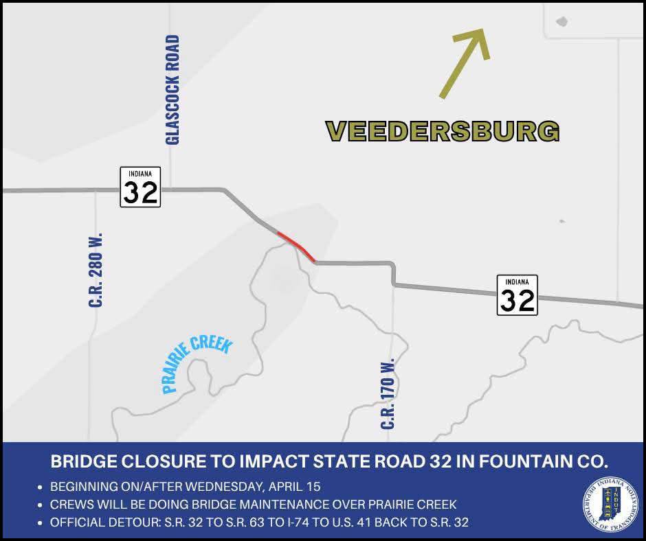 Bridge closure to impact State Road 32 over Prairie Creek in Fountain County
 13 members of armed drug trafficking and dog fighting ring sentenced
 Food sport’s biggest stage will be at Indiana State Fairgrounds & Event Center
 Education Union for ISTA staff files unfair labor charges
 People urged to take precautions against tick-borne disease as risk increases with warmer weather
 Hoosiers may qualify for free well water testing
 FBI joins search for missing Owen County woman
 Attorney General vows to protect Hoosiers from gas price gouging during temporary gas tax suspension
 Rockville Town Board hikes sewer fee, talks irrigation program
 Elevated fire weather risk in Central Indiana
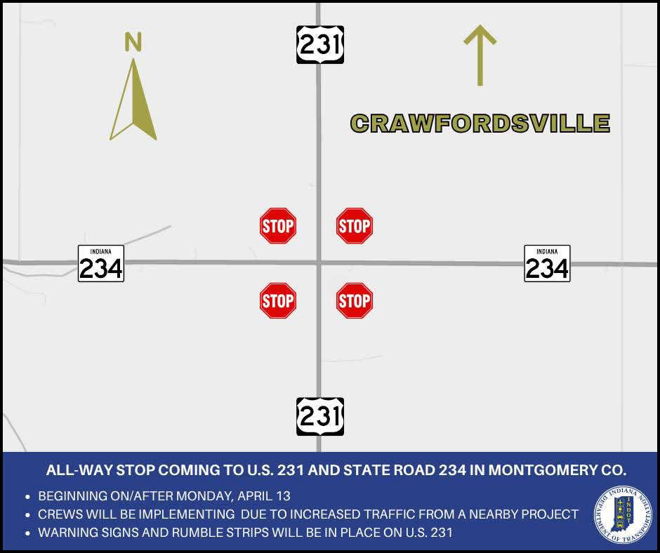 All-way stop coming to U.S. 231 and State Road 234 in Montgomery County