


The Illinois State Water Survey is partnering with the Federal Emergency Management Agency (FEMA) to examine the flood risk along five creeks in Lawrence County.
They are Brushy Creek, Muddy Creek, Shirley Creek, Indian Creek and the Indian Creek tributary.
Survey crews will be operating along those creeks beginning this month of May and continuing throughout the summer. The surveyors will be getting channel and bridge measurements along with topographic elevations and photographs within and around the creek banks to be used in computer models estimating the potential flooding threat.
The study will also be used to improve and update the Flood Insurance Rate Maps (FIRM) for Lawrence County. No property disruptions are anticipated.
 New online portal brings transparency to Indiana gas prices during declared energy emergency
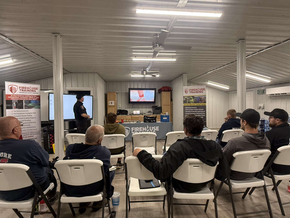 Electric vehicle fire training held at Rockville-Adams Township Training Center
 Indiana FSSA announces results of HCBS attendant care audits - $200 Million in improper payments
 Applications being accepted for Governor’s 2026 Century and Half Century Business Awards
 Indiana BMV extending hours for primary election
 $675 million impact reported from initial Regional Economic Development funding
 PHMS Amazing Shake
 Parke Heritage students in competition at FFA District Contest
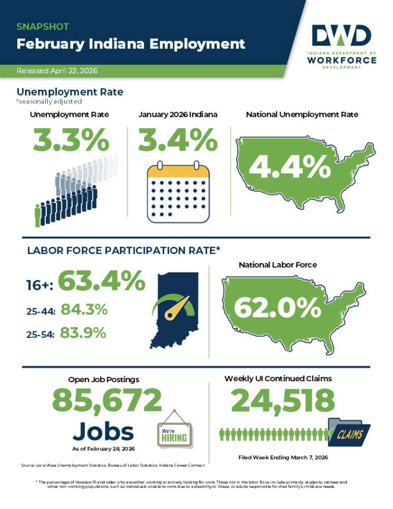 Indiana's February unemployment rate below national average
 Indiana hiring five county executive directors in training positions
 Be on the lookout for farm equipment on the road
 SW Parke projected to save over a million dollars closing Montezuma Elementary
 Changes coming to South Vermillion School Corporation's cell phone policy
 Crawfordsville man faces list of felony child sex charges
 Domestic incident results in arrest in Parke County
 Clinton man nabbed in burglary case