
Additional concerns for area flooding come with the threat posed by the latest forecast.
A Flood Watch is in effect from the National Weather Service through 2 a.m. Wednesday. Meanwhile, another round of thunderstorms is expected tonight. Flooding and damaging winds appear to be the primary threats.
The additional issue is the Monday temperatures. Heat indices in the mid-90s to near 100 degrees this afternoon.
There is a chance for additional thunderstorms on Tuesday.
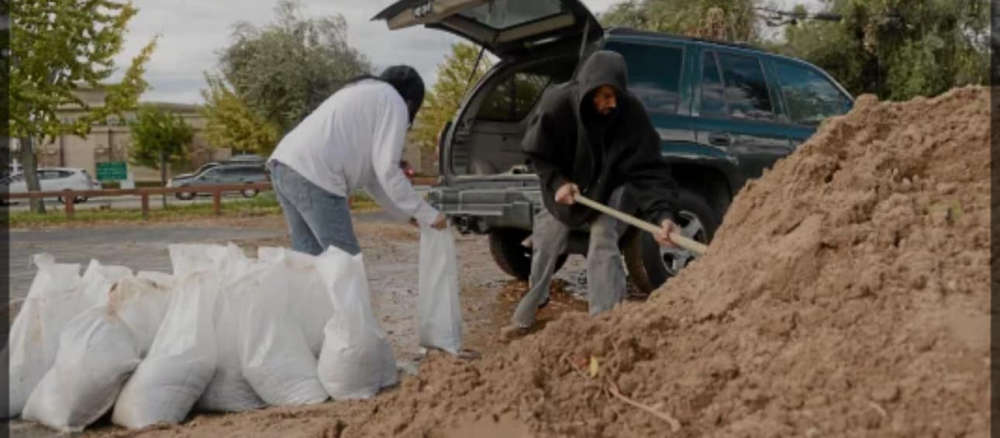
Fulton County Emergency Management is advising residents that rivers are coming out of their banks, along with usual flood areas.
The Highway Department has a load of sand at the Manitou boat ramp across from Dairy Queen on Highway 14 / 25.
Residents can pick up sandbags at the EMA office at 1728 E State Rd 14, Rochester, between 8 a.m.- 4 p.m. on Monday and Tuesday. An announcement will be made f there are extended dates and times for availability of those materials.
Please contact the office if you have further questions, 574-223-6611
 LCMH receives USDA federal grant for $450,000
 IDEM recycling grants available
 Lawrence County arrests
 Storm system rolls through southeastern Illinois and southwestern Indiana
 New PIO officer announced for Indiana State Police Evansville District
 Valentine seeks change of venue for murder trial
 Indiana Gov. Braun declares state of disaster emergency for 63 Indiana counties
 Newton power plant to be closed
 Lawrence County Board approves public safety tax referendum
 Library district in solid financial shape
 U.S. 41 road project continues in Knox County
 Richland County death investigation
 Vantlin named Heeps of Jeeps First Responder of the Year
 Vincennes University to upgrade Beckes Park
 Lawrenceville sewage plant visited by U.S. EPA
 Two dead after head-on collision in Crawford County
 First-ever statewide digital library resource program available in Illinois