


There is a chance of thunderstorms late this afternoon, especially by this evening as coverage of showers and thunderstorms increases.
The National Weather Service calling for an enhanced risk of severe storms late this afternoon and tonight generally along and west of Indiana State Road 15, with a slight risk of severe storms across the remainder of the area.
Large hail to two inches in diameter, damaging wind gusts, and tornadoes are all possible. Locally heavy rainfall is also expected tonight into early Wednesday morning. Confidence in severe weather occurring across the region is medium to high, but the exact locations with the greatest threats and timing of the initial storms late this afternoon and early this evening are of medium confidence.
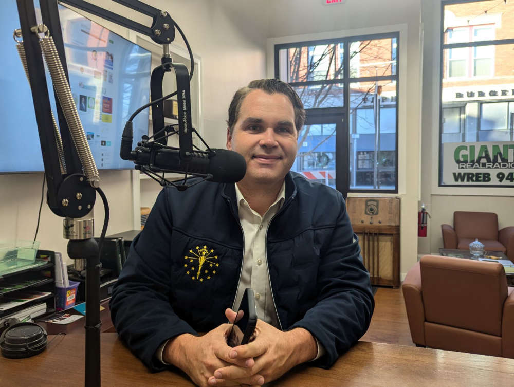 Governor ceremonially signs bill co-authored by Baird to combat animal cruelty
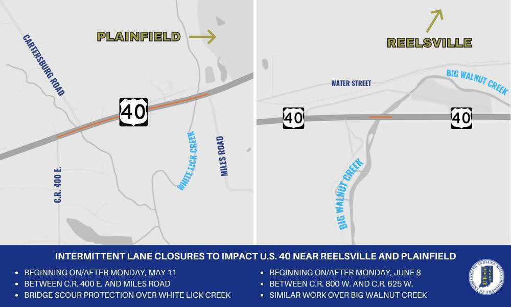 Intermittent lane closures to impact U.S. 40 in Hendricks, Putnam counties
 Putnam County man convicted in death of mother
 Greencastle man arrested for his role in Decatur County shooting
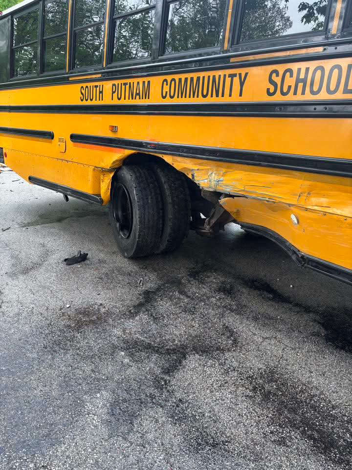 South Putnam bus, passenger vehicle crash Wednesday
 New online portal brings transparency to Indiana gas prices during declared energy emergency
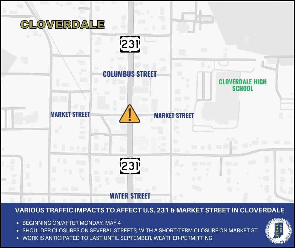 Several traffic impacts to affect the U.S. 231 & Market Street area in Cloverdale
 Tancak leaving future in hands of Cloverdale voters