


There is a chance of thunderstorms late this afternoon, especially by this evening as coverage of showers and thunderstorms increases.
The National Weather Service calling for an enhanced risk of severe storms late this afternoon and tonight generally along and west of Indiana State Road 15, with a slight risk of severe storms across the remainder of the area.
Large hail to two inches in diameter, damaging wind gusts, and tornadoes are all possible. Locally heavy rainfall is also expected tonight into early Wednesday morning. Confidence in severe weather occurring across the region is medium to high, but the exact locations with the greatest threats and timing of the initial storms late this afternoon and early this evening are of medium confidence.
 Indiana Department of Veterans Affairs, American Legion Department of Indiana sign landmark agreement
 Brazil man arrested on rape, other charges
 Cloverdale Town Board puts end to fire territory rumors
 GE Aerospace to make millions of dollars of investment in Terre Haute, Lafayette
 Rodney Atkins to perform at Putnam County Fairgrounds
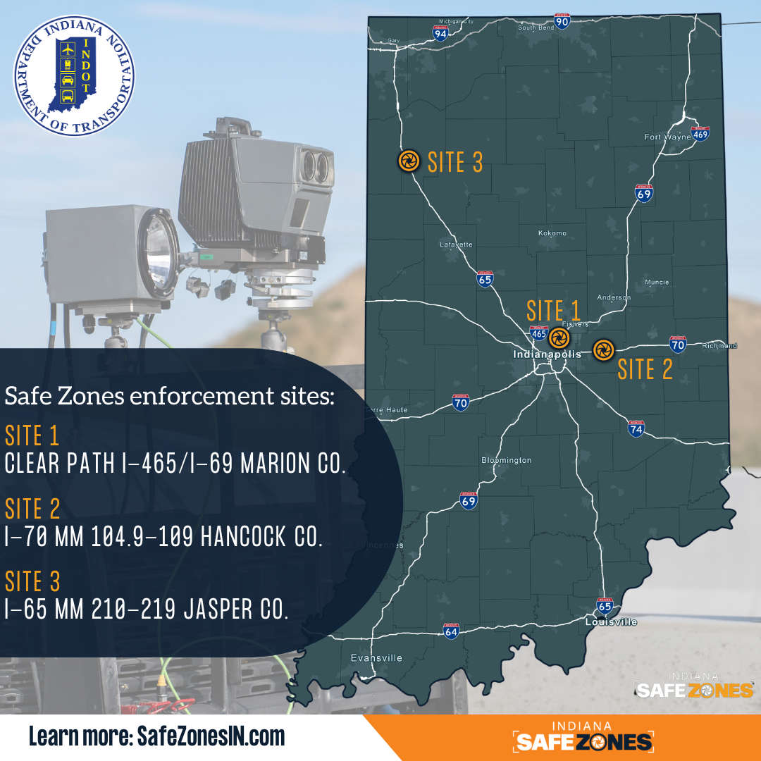 Safe Zones enforcement to resume on I-70 in Hancock Co., begin on I-65 in Jasper Co.
 IDHS focuses on raising awareness during Severe Weather Preparedness Week, March 8-14