
wako news
The Illinois Department of Transportation (IDOT) this week announced that it has released the new official state highway map. The map includes new features including route updates and mileages between towns and marked route junctions to assist travelers more readily as they explore the state. The map is paid for with funding from the Federal Highway Administration (FHA) and is published by IDOT every two years. Free copies are available at interstate rest stops and other IDOT facilities. They can also be requested through the website DOT.maps@illinois.gov.
 Woman who purchased Powerball ticket in La Porte claims millions in winnings
 Logansport woman accused of stealing $50,000 from vulnerable relative
 Around 30 firefighters battle Bunker Hill structure fire
 Indiana State Police-Peru District shares holiday patrol results
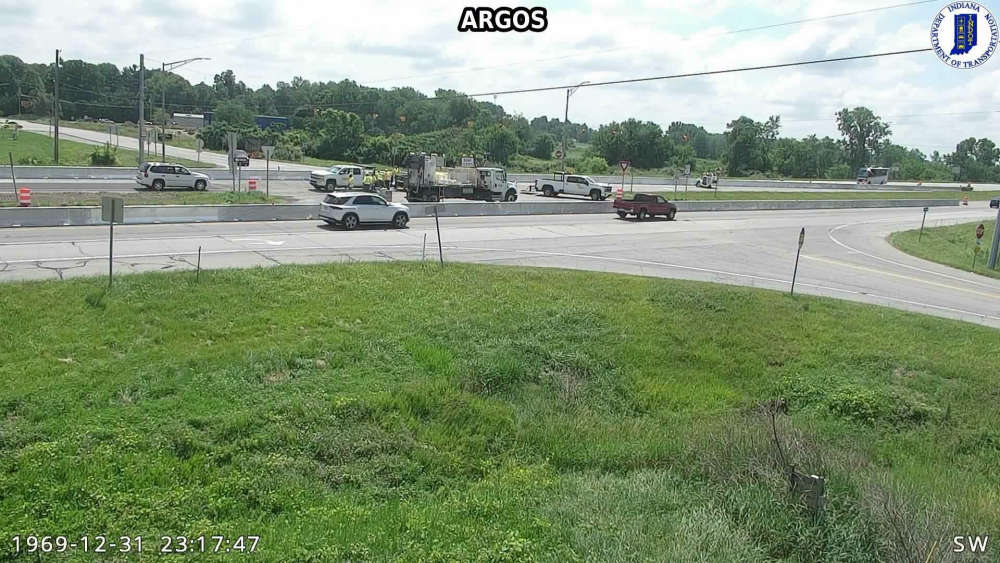 U.S. 31 and State Road 10 Reduced Conflict Intersection (RCI) project update
 Housing opportunities growing, water-sewer bids accepted for Rochester project
 Garth Brooks announces The Blame It All On My Roots Tour kicking off at Gainbridge Fieldhouse
 Argos teen crowned 2026 Indiana State Miss Flame at IVFA Convention