

wako news
The Illinois Department of Transportation (IDOT) this week announced that it has released the new official state highway map. The map includes new features including route updates and mileages between towns and marked route junctions to assist travelers more readily as they explore the state. The map is paid for with funding from the Federal Highway Administration (FHA) and is published by IDOT every two years. Free copies are available at interstate rest stops and other IDOT facilities. They can also be requested through the website DOT.maps@illinois.gov.
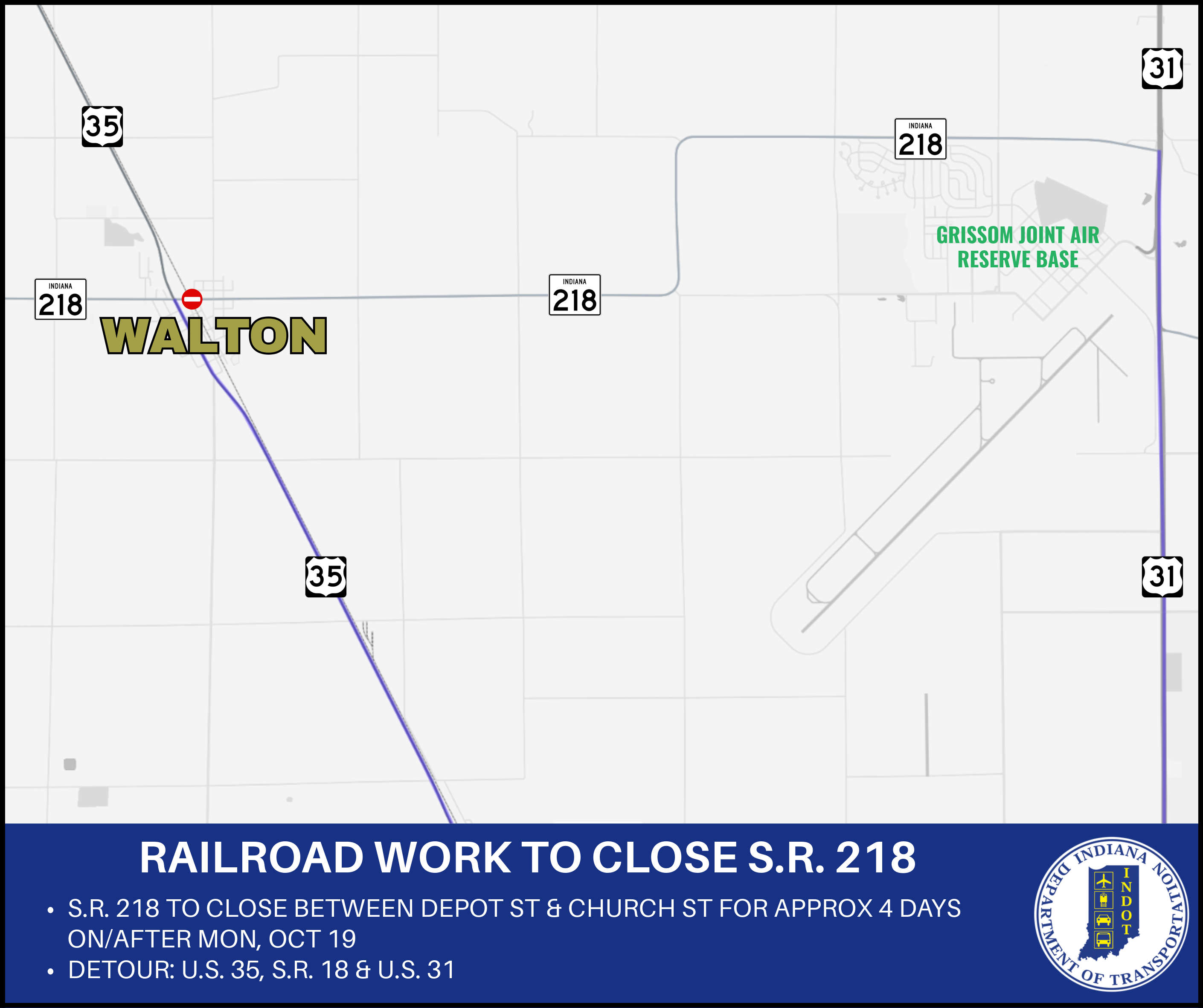 State Road 218 to close in Walton for railroad work
 Stay alert and share the road with farm equipment this fall
 Gas prices on the rise in Indiana
 Ivy Tech sets new record for completions
 IDHS warns against disaster assistance fraud
 Applications open for Indiana's Advanced Nuclear Ready Communities Program
 USPS schedule for weekend into Columbus Day