


The National Weather Service has issued a STRONG THUNDERSTORM WILL IMPACT MARSHALL COUNTY at about 5:15 PM.
At 427 PM EDT/327 PM CDT/, Doppler radar was tracking a strong
thunderstorm near Ora, or 9 miles northeast of Winamac, moving
northeast at 30 mph.
HAZARD...Wind gusts up to 50 mph and half inch hail.
SOURCE...Radar indicated.
IMPACT...Gusty winds could knock down tree limbs and blow around unsecured objects. Minor hail damage to vegetation is possible.
Locations impacted include...
Plymouth, Bremen, Knox, Bourbon, Argos, Culver, Walnut, Tippecanoe,
Oak Grove, Monterey, Leiters Ford, Ober, Twin Lakes, Inwood, Rutland,
Burr Oak, Maxinkuckee, Hibbard, Winona, and Delong.
PRECAUTIONARY/PREPAREDNESS ACTIONS...
If outdoors, consider seeking shelter inside a building.
 Keystone Cooperative announces next CEO
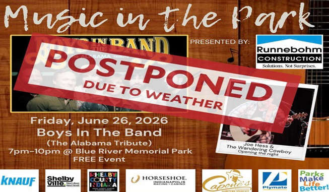 Shelbyville Parks and Recreation Department postpones Friday's Music in the Park concert
 Hope man sentenced to prison for charges on two incidents in December 2024
 Kroger members can now redeem Points for dollars off groceries in-store and online
 Person dead of self-inflicted gunshot in Shelbyville church parking lot
 Shelby County Plan Commission moves up August meeting on data center ordinance with moratorium deadline approaching
 $50,000 winning Powerball ticket sold in Greenfield
 Countrymark fueling stations hosting Fueling Freedom on Friday