

The National Weather Service has issued a STRONG THUNDERSTORM WILL IMPACT MARSHALL COUNTY at about 5:15 PM.
At 427 PM EDT/327 PM CDT/, Doppler radar was tracking a strong
thunderstorm near Ora, or 9 miles northeast of Winamac, moving
northeast at 30 mph.
HAZARD...Wind gusts up to 50 mph and half inch hail.
SOURCE...Radar indicated.
IMPACT...Gusty winds could knock down tree limbs and blow around unsecured objects. Minor hail damage to vegetation is possible.
Locations impacted include...
Plymouth, Bremen, Knox, Bourbon, Argos, Culver, Walnut, Tippecanoe,
Oak Grove, Monterey, Leiters Ford, Ober, Twin Lakes, Inwood, Rutland,
Burr Oak, Maxinkuckee, Hibbard, Winona, and Delong.
PRECAUTIONARY/PREPAREDNESS ACTIONS...
If outdoors, consider seeking shelter inside a building.
 Ride the Lightning fundraiser final results puts Andy Brubaker in hot seat
 Pulaski County Sheriff's Office warn locals about recent jail bond scams
 Rochester man accused of stalking woman with cameras and tracking device
 Bill signed to prohibit cell phones, wireless devices in schools
 110th running of the Indianapolis 500 a sellout, local TV delay lifted
 Pierceton man arrested for Possession of Sex Abuse Material following Indiana State Police investigation
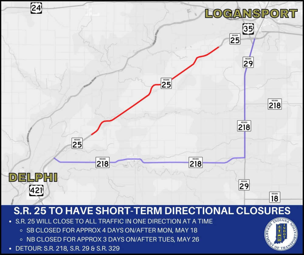 INDOT with directional closures on State Road 25 between U.S. 35 and State Road 218 for seal coating operations