News
The National Weather Service has issued a STRONG THUNDERSTORM WILL IMPACT MARSHALL COUNTY
at about 5:15 PM.
At 427 PM EDT/327 PM CDT/, Doppler radar was tracking a strong
thunderstorm near Ora, or 9 miles northeast of Winamac, moving
northeast at 30 mph.
HAZARD...Wind gusts up to 50 mph and half inch hail.
SOURCE...Radar indicated.
IMPACT...Gusty winds could knock down tree limbs and blow around
unsecured objects. Minor hail damage to vegetation is
possible.
Locations impacted include...
Plymouth, Bremen, Knox, Bourbon, Argos, Culver, Walnut, Tippecanoe,
Oak Grove, Monterey, Leiters Ford, Ober, Twin Lakes, Inwood, Rutland,
Burr Oak, Maxinkuckee, Hibbard, Winona, and Delong.
PRECAUTIONARY/PREPAREDNESS ACTIONS...
If outdoors, consider seeking shelter inside a building.
 Indiana's county fairs allowed alcohol service areas starting July 1
 Kroger members can now redeem Points for dollars off groceries in-store and online
 First responders rescue multiple people in recent days
 Countrymark fueling stations hosting Fueling Freedom on Friday
 Step right up! Big Top Circus presented by Bee Window returns to the Indiana State Fair
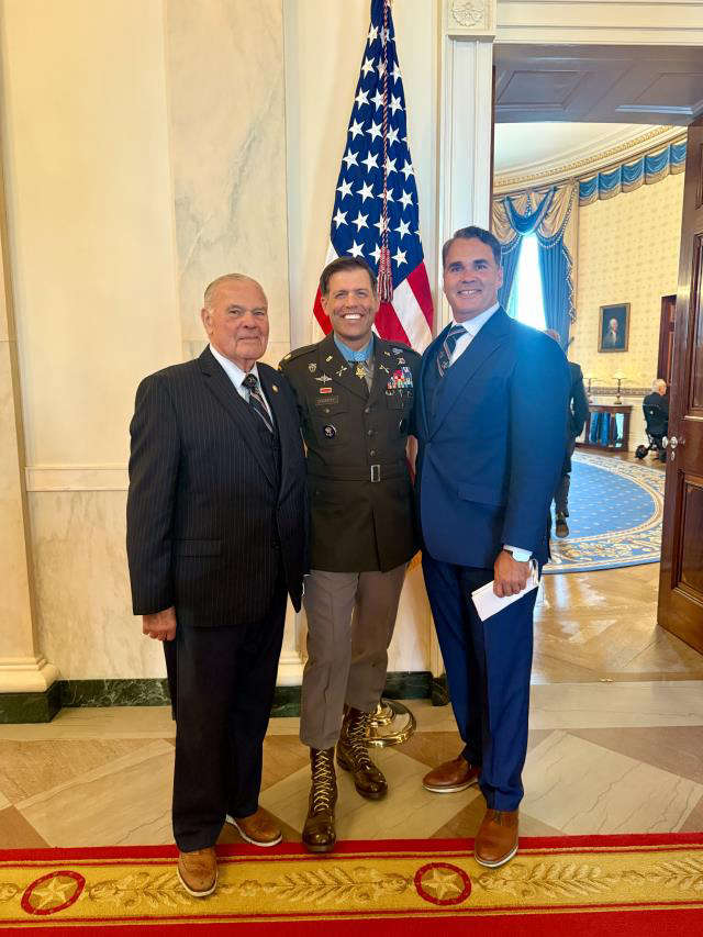 Congressman Baird ioins President Trump for Medal of Honor ceremony for Major Nicholas Dockery
 INDOT with chip seal operations on area roads
 Conservation officer serving Vermillion Co. completes advanced public safety diving instructor training
 May unemployment rate in state still below national average
 IDEM recycling grants available
 Identity released in fatal U.S. 36 crash
 Longtime educator tabbed to lead new Montezuma Elementary
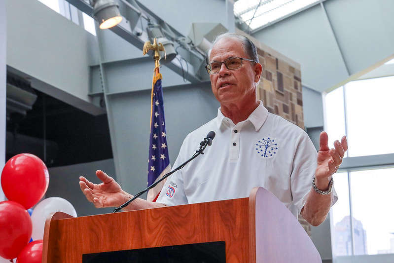 Gov. Braun unveils Indiana’s exhibit for the National Mall during The Great American State Fair
 Nominations now open for farmers and ranchers to serve on USDA Farm Service Agency county committees
 CBP officers in Indianapolis seize counterfeit FIFA World Cup 2026 merchandise
 Former Cloverdale coach lands back in coaching