

News
The National Weather Service has issued a STRONG THUNDERSTORM WILL IMPACT MARSHALL COUNTY
at about 5:15 PM.
At 427 PM EDT/327 PM CDT/, Doppler radar was tracking a strong
thunderstorm near Ora, or 9 miles northeast of Winamac, moving
northeast at 30 mph.
HAZARD...Wind gusts up to 50 mph and half inch hail.
SOURCE...Radar indicated.
IMPACT...Gusty winds could knock down tree limbs and blow around
unsecured objects. Minor hail damage to vegetation is
possible.
Locations impacted include...
Plymouth, Bremen, Knox, Bourbon, Argos, Culver, Walnut, Tippecanoe,
Oak Grove, Monterey, Leiters Ford, Ober, Twin Lakes, Inwood, Rutland,
Burr Oak, Maxinkuckee, Hibbard, Winona, and Delong.
PRECAUTIONARY/PREPAREDNESS ACTIONS...
If outdoors, consider seeking shelter inside a building.
 Alliance Bank in Francesville recognized in Forbes list
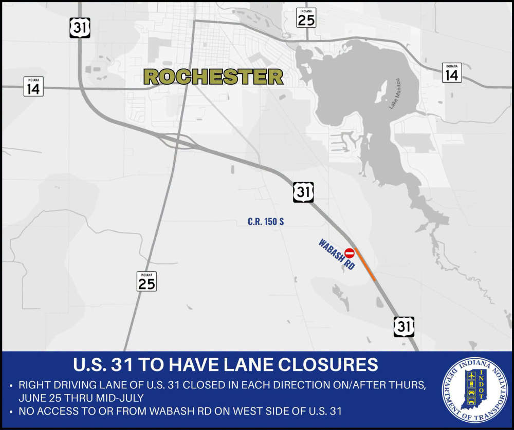 U.S. 31 road project scheduled to begin Thursday
 Fulton County unemployment matches Indiana's but well below the national rate
 Countrymark fueling stations hosting Fueling Freedom on Friday
 Step right up! Big Top Circus presented by Bee Window returns to the Indiana State Fair
 Town of Argos releases 2040 Comprehensive Plan draft; public comment period open until July 7
 NASCAR Star Ryan Newman headlines action-packed night at Plymouth Motor Speedway this Saturday
 May unemployment rate in state still below national average