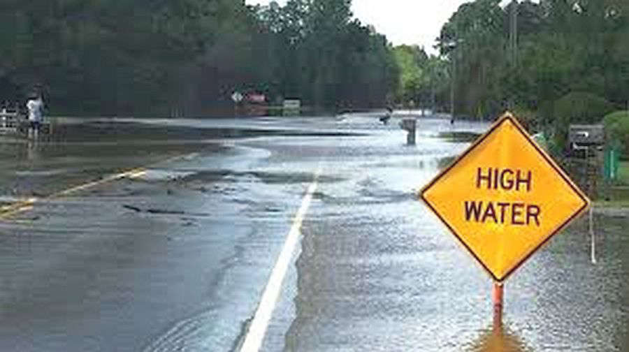
The National Weather Service (NWS) reports that a severe weather system rumbled through southeastern Illinois and southwestern Indiana Monday night with strong winds, hail, and heavy rainfall resulting in severe thunderstorm and tornado watches and warnings.
Warning sirens sounded off in Lawrenceville around 9:25 p.m. CT as the storms moved in from the west-southwest. Tornado warnings were issued for areas of southwestern, southern and southeastern Lawrence County. Most of the damage done was wind-related with downed trees blocking roadways and the heavy rains caused several streets and roads to flood. Scattered thundershowers are forecast for Tuesday evening, but severe weather is not likely, but additional rainfall up to over a half of an inch is possible.
The Embarras River is under a Flood Warning from Tuesday, April 28th through Monday May 4th due to 3 to 5 inches of rainfall that fell over portions of the lower river basin on Monday. It is rising and expected to reach above it's 30-foot flood stage Tuesday afternoon.
 Countrymark fueling stations hosting Fueling Freedom on Friday
 Step right up! Big Top Circus presented by Bee Window returns to the Indiana State Fair
 Congressman Baird ioins President Trump for Medal of Honor ceremony for Major Nicholas Dockery
 INDOT with chip seal operations on area roads
 Conservation officer serving Vermillion Co. completes advanced public safety diving instructor training
 May unemployment rate in state still below national average
 IDEM recycling grants available
 Identity released in fatal U.S. 36 crash
 Indiana Gov. Braun declares state of disaster emergency for 63 Indiana counties
 Longtime educator tabbed to lead new Montezuma Elementary
 Gov. Braun unveils Indiana’s exhibit for the National Mall during The Great American State Fair
 Nominations now open for farmers and ranchers to serve on USDA Farm Service Agency county committees
 CBP officers in Indianapolis seize counterfeit FIFA World Cup 2026 merchandise
 Former Cloverdale coach lands back in coaching
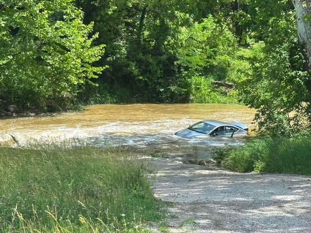 Three pulled safely from submerged car