
Marshall County will be under a Winter Storm Watch beginning this afternoon at 4:30 and continuing through Thursday at 1 p.m.
Heavy lake effect snow is possible with total snow accumulations estimated to be between 4 and 9 inches. Northwest Winds could gust between 35 and 40 mph at times. Once the snow accumulates, blowing and drifting snow could be problematic for east-west roads.
Travel could be very difficult with hazardous conditions on Wednesday morning and evening commutes, and the Thursday morning commute.
Residents are encouraged to monitor the latest forecasts for updates on this situation and consider delaying all travel. If travel is necessary, drive with extreme caution and consider taking a winter storm kit with you. The kit should include tire chains, booster cables, a flashlight, a shovel, blankets, and extra clothing. Also take water, a first aid kit, and food in case you become stranded.
During lake effect snow, the weather can vary from bands of locally heavy snow to dry weather just a few miles away. Visibility can also vary greatly, so be prepared for rapid changes in weather, visibility, and road conditions.
 Former postal worker among trio charged with stealing $255k in prepaid debit cards
 Trainer Tony Cunningham scores 1,000th Quarter Horse win at Horseshoe Indianapolis
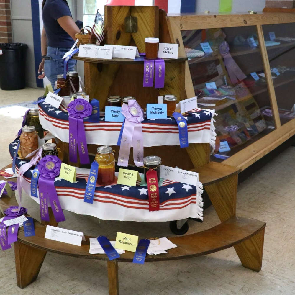 Open Class Shelby County Fair results released
 Crossroads of America SongFarmers with free patriotic celebration on Monday at SCPL
 Almost $3M in stolen tungsten oxide powder meant for Japan recovered in Hancock County
 Deadlines approaching for BRCF City and County Progress Grant cycle
 Keystone Cooperative announces next CEO
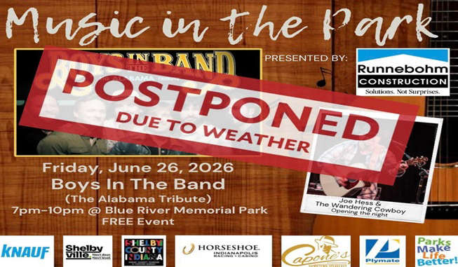 Shelbyville Parks and Recreation Department postpones Friday's Music in the Park concert