

Marshall County will be under a Winter Storm Watch beginning this afternoon at 4:30 and continuing through Thursday at 1 p.m.
Heavy lake effect snow is possible with total snow accumulations estimated to be between 4 and 9 inches. Northwest Winds could gust between 35 and 40 mph at times. Once the snow accumulates, blowing and drifting snow could be problematic for east-west roads.
Travel could be very difficult with hazardous conditions on Wednesday morning and evening commutes, and the Thursday morning commute.
Residents are encouraged to monitor the latest forecasts for updates on this situation and consider delaying all travel. If travel is necessary, drive with extreme caution and consider taking a winter storm kit with you. The kit should include tire chains, booster cables, a flashlight, a shovel, blankets, and extra clothing. Also take water, a first aid kit, and food in case you become stranded.
During lake effect snow, the weather can vary from bands of locally heavy snow to dry weather just a few miles away. Visibility can also vary greatly, so be prepared for rapid changes in weather, visibility, and road conditions.
 Keystone Cooperative announces next CEO
 Community Foundation awards $50,000 grant to support Matthew's Market
 1982 Caston graduate retiring after 37 years in law enforcement
 Indiana's county fairs allowed alcohol service areas starting July 1
 Kroger members can now redeem Points for dollars off groceries in-store and online
 "Bicentennial Culver" this Saturday
 Alliance Bank in Francesville recognized in Forbes list
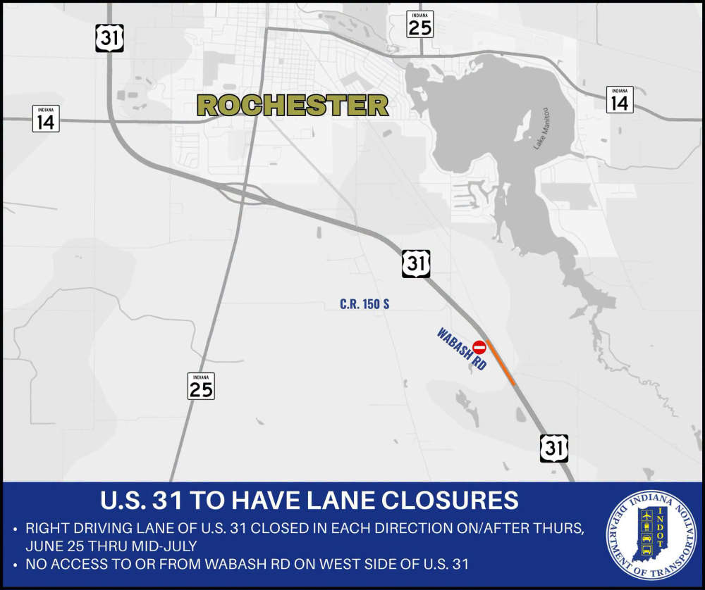 U.S. 31 road project scheduled to begin Thursday