

"
...WINTER WEATHER ADVISORY REMAINS IN EFFECT FROM 4 PM THIS_x000D_ AFTERNOON TO 10 AM EST TUESDAY..._x000D_ _x000D_ * WHAT...Freezing rain expected. Total ice accumulations of around_x000D_ one tenth of an inch with isolated spots up to two tenths._x000D_ _x000D_ * WHERE...Portions of central, north central, southwest and west_x000D_ central Indiana._x000D_ _x000D_ * WHEN...From 4 PM this afternoon to 10 AM EST Tuesday._x000D_ _x000D_ * IMPACTS...Difficult travel conditions are possible. The_x000D_ hazardous conditions could impact the morning commute._x000D_ _x000D_ * ADDITIONAL DETAILS...Freezing rain overspreads the region from_x000D_ west to east Monday evening. Heaviest freezing rain rates_x000D_ expecting during the overnight hours. Lower confidence exists_x000D_ in the transition time from freezing rain to rain as warmer_x000D_ air surges north Tuesday morning._x000D_ _x000D_ PRECAUTIONARY/PREPAREDNESS ACTIONS..._x000D_ _x000D_ Slow down and use caution while traveling. Prepare for possible_x000D_ power outages.
 Owen Valley HS receives FEMA grant for repair from 2025 Spring storms
 One week left to file for office in Indiana
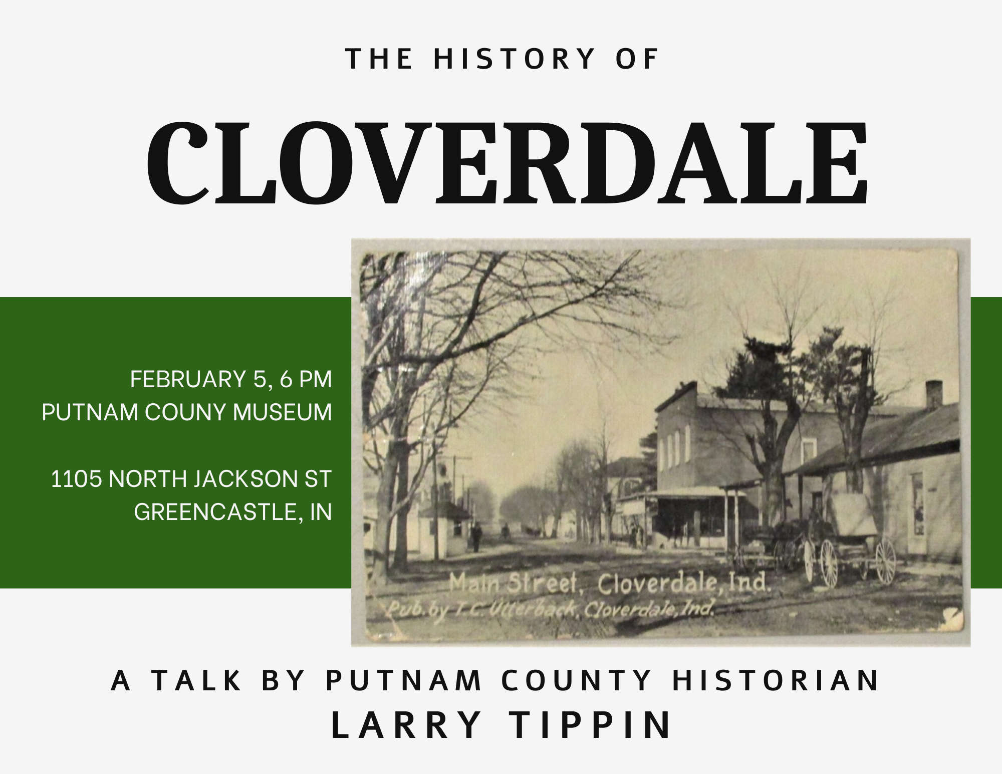 History of Cloverdale – Talk at Putnam County Museum
 “Exploring 4-H” for Grade 2 Kicks off in February
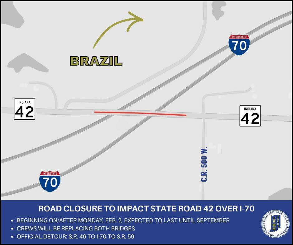 Bridge closures to impact State Road 42 over I-70 in Clay County
 South Putnam's Burgess leaves the Nest
 LEGO® Fans Food Drive
 Road renaming resolution co-authored by Criswell to honor Bobby Knight passes House

