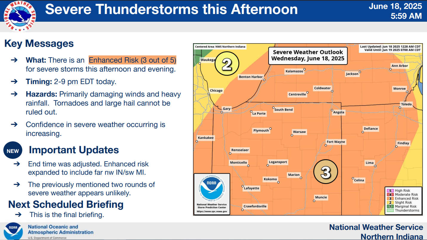
The National Weather Service for Northern Indiana has placed Marshall County in the "Enhanced Risk," which is a level 3 of 5, for severe storms this afternoon and evening.
Confidence is increasing that a line of severe thunderstorms will pass through Marshall County between 2 pm and 7 pm today.
This morning's line of storms is NOT an early arrival of the severe line.
Damaging winds, heavy rainfall, and, to a lesser extent, tornadoes and large hail are the primary threats in this afternoon and evening's scenarios. Storms will produce heavy rainfall rates of 1 to 2 inches per hour.
 Indianapolis Indians named title partner of the 2026 Indiana State Fair
 Rescued bald eagle succumbs to complications
 New Space Force license plate design
 Hollywood actor found dead in Putnam County
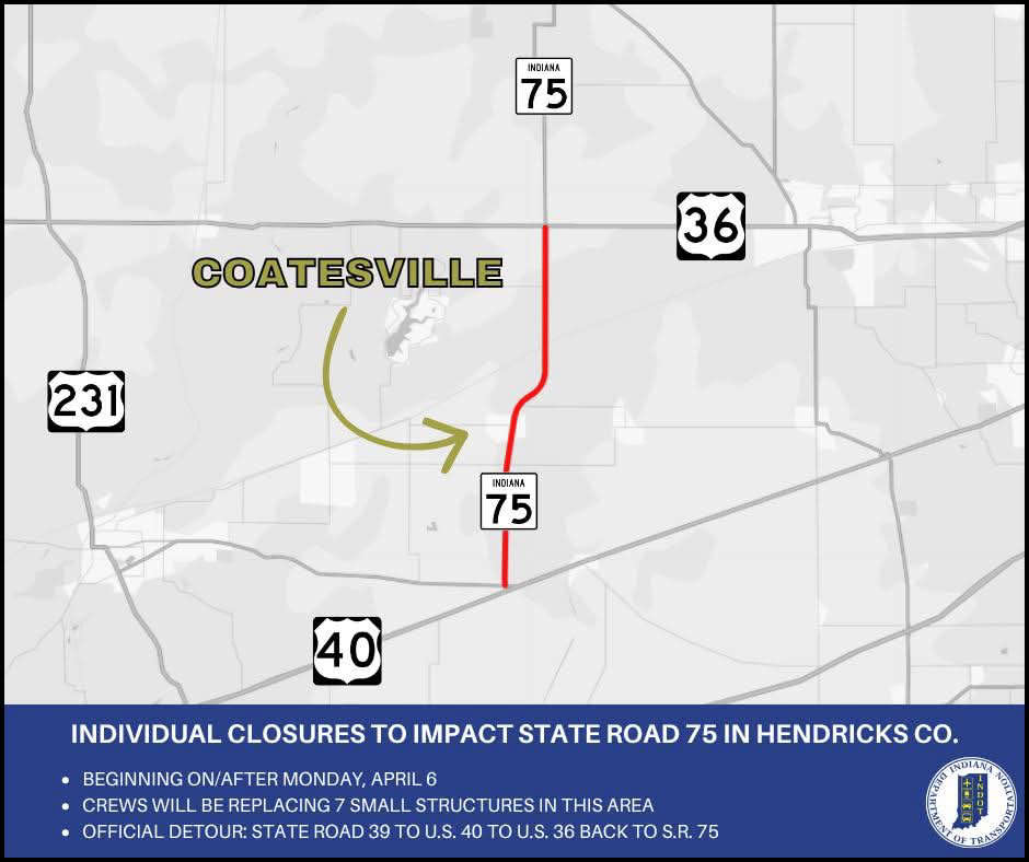 Several closures to impact State Road 75 in Hendricks County
 Indiana announces launch of enhanced system for Hoosier military and overseas voters
 Cloverdale Town Board votes new leadership