

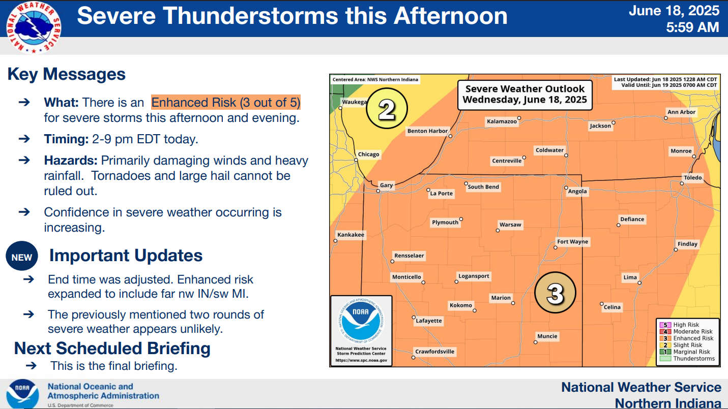
The National Weather Service for Northern Indiana has placed Marshall County in the "Enhanced Risk," which is a level 3 of 5, for severe storms this afternoon and evening.
Confidence is increasing that a line of severe thunderstorms will pass through Marshall County between 2 pm and 7 pm today.
This morning's line of storms is NOT an early arrival of the severe line.
Damaging winds, heavy rainfall, and, to a lesser extent, tornadoes and large hail are the primary threats in this afternoon and evening's scenarios. Storms will produce heavy rainfall rates of 1 to 2 inches per hour.
 Two dead in Decatur County fire
 Legendary 'Indiana Rangers' receive Presidential Unit Citation, Sagamore of the Wabash for Vietnam War heroism
 Rushville's Booker T. Washington School receives restoration and rehab grant
 Column: Goodbye America
 Meta to pay up to $419M to Indiana, implement sweeping child-safety reforms on Instagram and Facebook
 Indiana Pork and Indiana Beef donate State Fair food to support flood-ravaged communities