

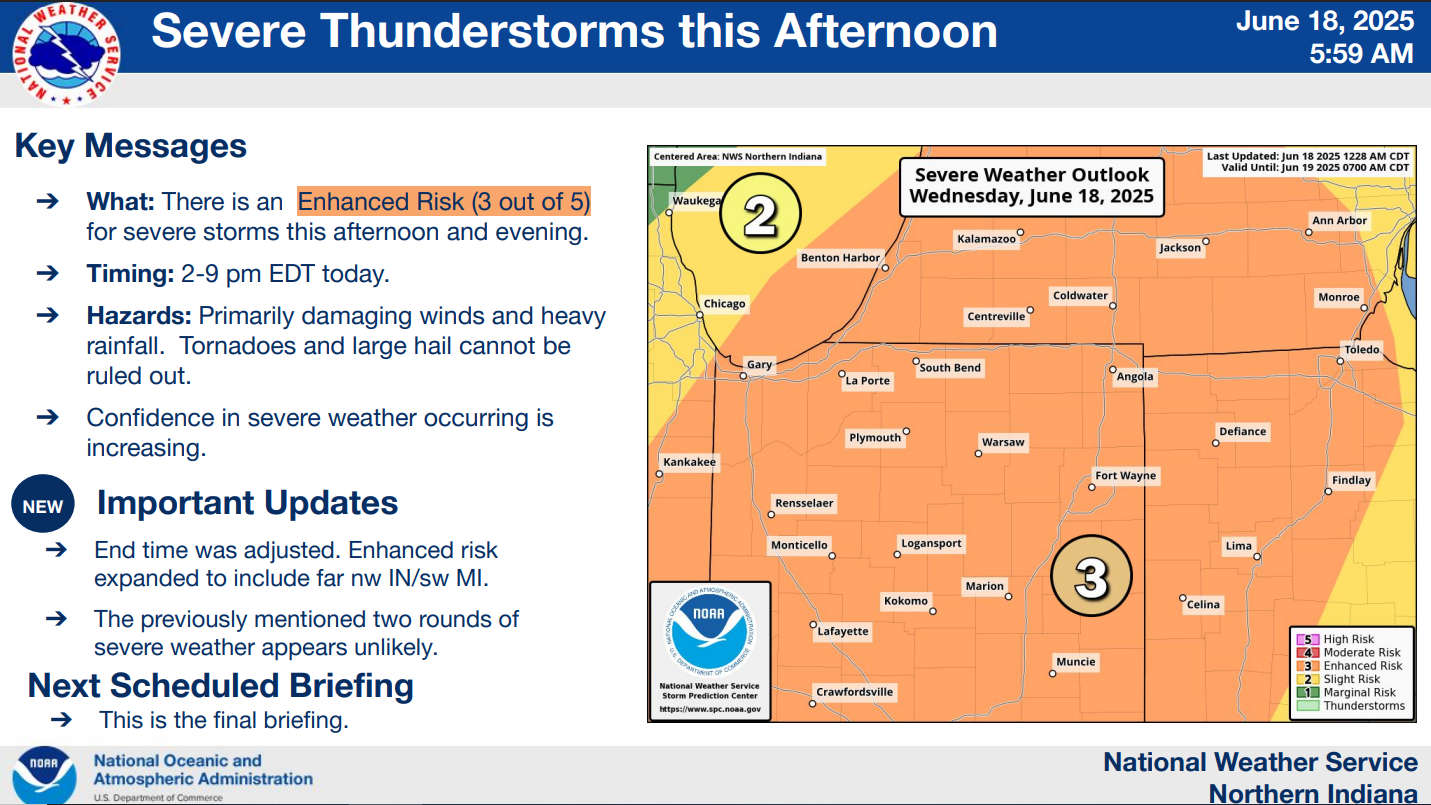
The National Weather Service for Northern Indiana has placed Marshall County in the "Enhanced Risk," which is a level 3 of 5, for severe storms this afternoon and evening.
Confidence is increasing that a line of severe thunderstorms will pass through Marshall County between 2 pm and 7 pm today.
This morning's line of storms is NOT an early arrival of the severe line.
Damaging winds, heavy rainfall, and, to a lesser extent, tornadoes and large hail are the primary threats in this afternoon and evening's scenarios. Storms will produce heavy rainfall rates of 1 to 2 inches per hour.
 Phase II complete on Parke County Rail Trail
 Parke County officials seek info in Coxville Bridge damage
 Lineup of 50 new food creations featured during this year's Indiana State Fair
 Indiana wrapping up recounts in three legislative races
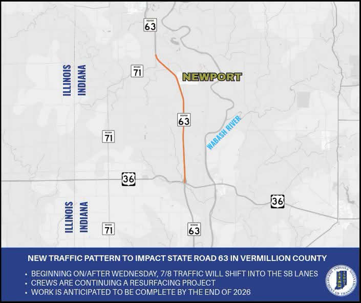 New traffic pattern to impact State Road 63 in Vermillion County
 Garth Brooks announces The Blame It All On My Roots Tour kicking off at Gainbridge Fieldhouse
 Art and photo contest open for DNR hard card licenses
 IFB: Summer cookout costs decrease for Indiana shoppers, lower than U.S. average
 $22 million Fourth of July water roller coaster coming to Holiday World & Splashin’ Safari
 ISDA Launches IMAGE Cost-Share Program for southwest Indiana producers
 July 4th: Red Cross offers safety tips for a harmless holiday
 Full steam ahead: Indiana State Fair to debut new Family Train Ride in 2026
 Governor Braun highlights America 250 Celebrations, encourages communities to participate with sSpecial grant program
 Arts grant to support Parke Players’ summer musical, Ritz Theater
 Missing teen Peyton Fulk found in Florida