Last night's snowfall outdid expectations, but we aren't done yet. The real stuff starts later today, upgraded the Winter Storm Watch into a Warning running through 7 PM Monday.
The National Weather Service predicts lake effect snow bands over the next 36 hours.
The updated snowfall map has most of Marshall County receiving 4-8" of new snowfall after what we already received last night.
Marshall County Emergency Management Agency Director Jack Garner will be keeping a close eye on the roads. Drivers should expect hazardous travel conditions, especially during periods of high snowfall rates.
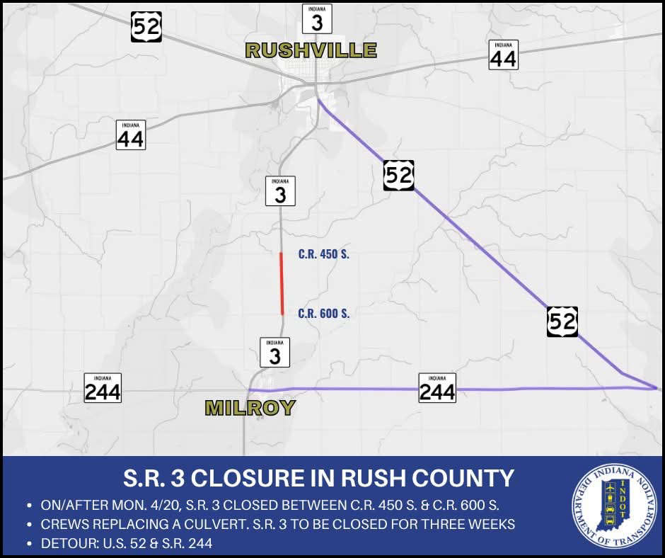 State Road 3 to close for culvert replacement in Rush County
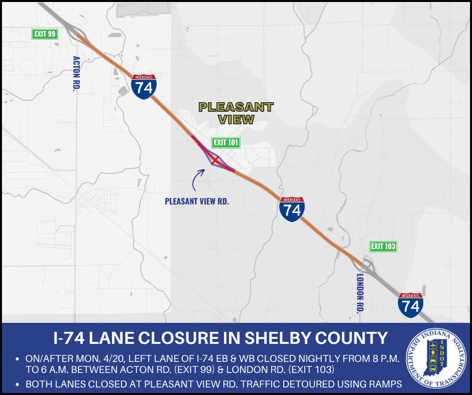 Nightly lane closures planned on I-74 in Shelby County
 Woman seriously injured in Decatur County crash
 Education Union for ISTA staff files unfair labor charges
 People urged to take precautions against tick-borne disease as risk increases with warmer weather
 NFHS launches free course on risk of sports betting for high school students
 Juvenile runaway Kylor Craig, 17, of Greenfield
 Rushville man arrested after cyber tip from the National Center for Missing and Exploited Children