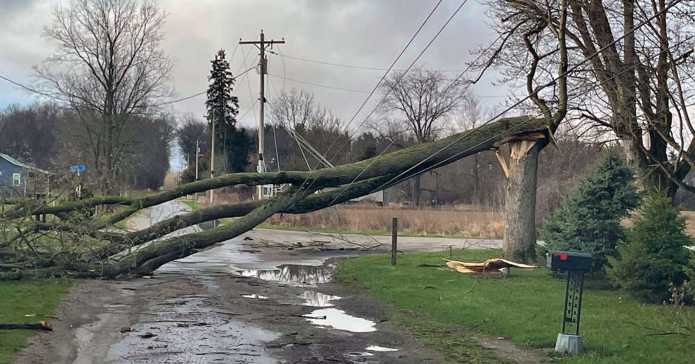
The National Weather Service (NWS) has announced confirmation of two EF-1 tornadoes in southeastern Illinois Wednesday evening.
Storm survey teams report that the first touched down at approximately 6:10 p.m. CT southeast of Altamont.
It produced peak winds of 105 mph and traveled about 3 miles with a width of 125 yards and damaged a residential roof and some trees.
The second occurred south of Montrose around 6:25 p.m. CT.
It packed peak winds estimated at 125 mph and traveled about 4 miles and was about 100 yards wide.
The twister traveled northeast and damaged some farm outbuildings and power poles before lifting near the Jasper County line.
There were no serious injuries reported.
The NWS says assessment teams are continuing to work to confirm any other tornado touchdowns in the region.
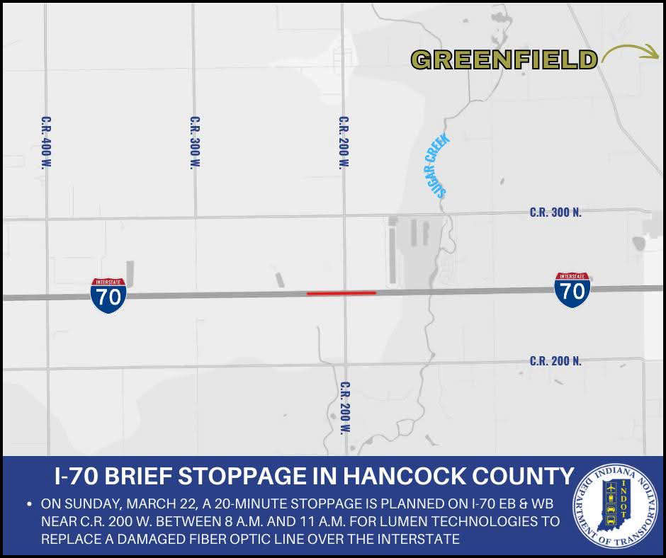 I-70 stopped Sunday in Hancock County
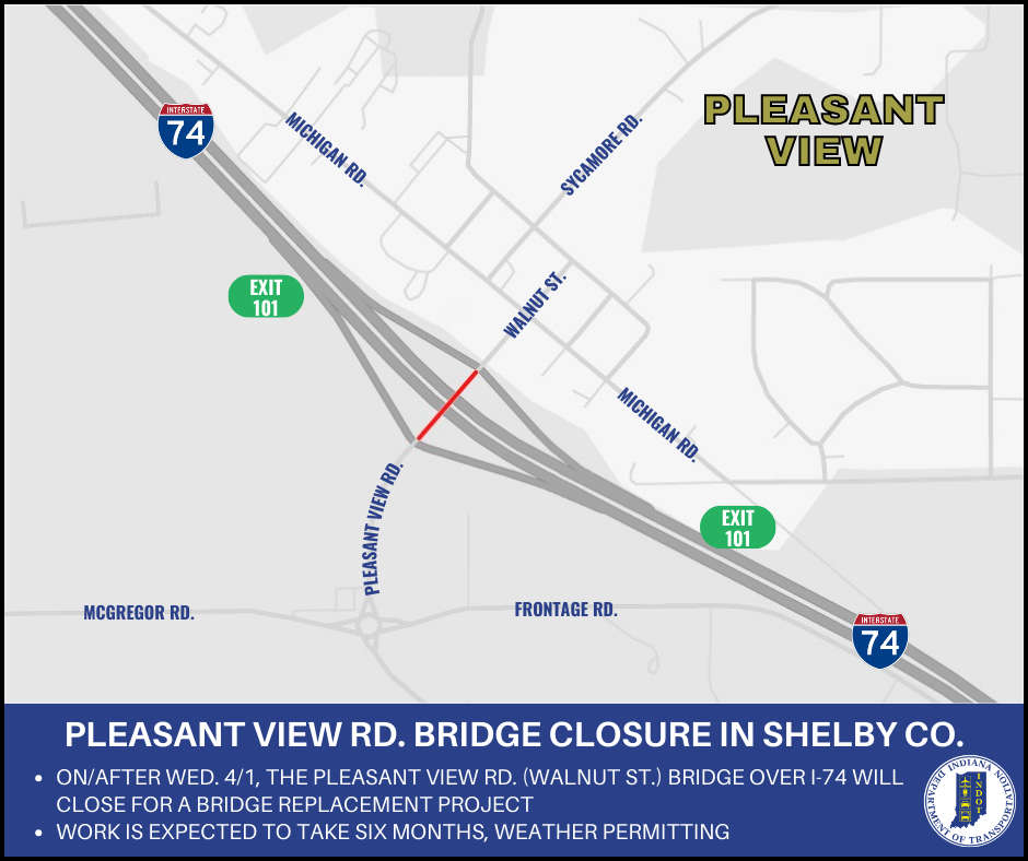 Pleasant View Road bridge over I-74 to close for bridge replacement in Shelby County
 Experienced Parke Heritage next up for Triton Central
 Shelbyville's Harry Larrabee inducted into Indiana Basketball Hall of Fame
 February real estate market provides positive outlook for spring season
 SCS hosting educational workshop on online predators
 Safe Zones enforcement to begin on I-74
 VA announces $112M grant opportunity to strengthen community-based suicide prevention efforts