

"
.DAY ONE...Today and Tonight._x000D_ _x000D_ A WIND ADVISORY is in effect from 1000 AM until 400 PM. Wind_x000D_ gusts of 40-45 mph will be possible today. Even higher gusts to_x000D_ near 55 mph will be possible this evening._x000D_ _x000D_ Light snow showers are possible Friday night into early Saturday,_x000D_ with accumulations near 1 inch possible. Snow combining with gusty_x000D_ winds may result in reduced visibility. Slick spots may develop_x000D_ on roads._x000D_ _x000D_ .DAYS TWO THROUGH SEVEN...Saturday through Thursday._x000D_ _x000D_ Wind gusts to around 40 mph will be possible on Saturday morning._x000D_ _x000D_ A prolonged period of frigid temperatures are expected Saturday_x000D_ night into next week. Air temperatures will fall to below zero for_x000D_ parts of the area Sunday night and Monday night. Wind chills may_x000D_ approach 20 below zero for parts of the area by Tuesday morning._x000D_ _x000D_ The bitterly cold temperatures will raise concerns for ice jams_x000D_ along area rivers and streams from late this weekend into next_x000D_ week.
 Fire vs Police on the hardwood for good cause Friday night
 Indiana AG warns of human trafficking during Final Four
 Authorities looking for missing Owen County female
 Application period now open for POET Bioprocessing – Cloverdale Community Impact Grants
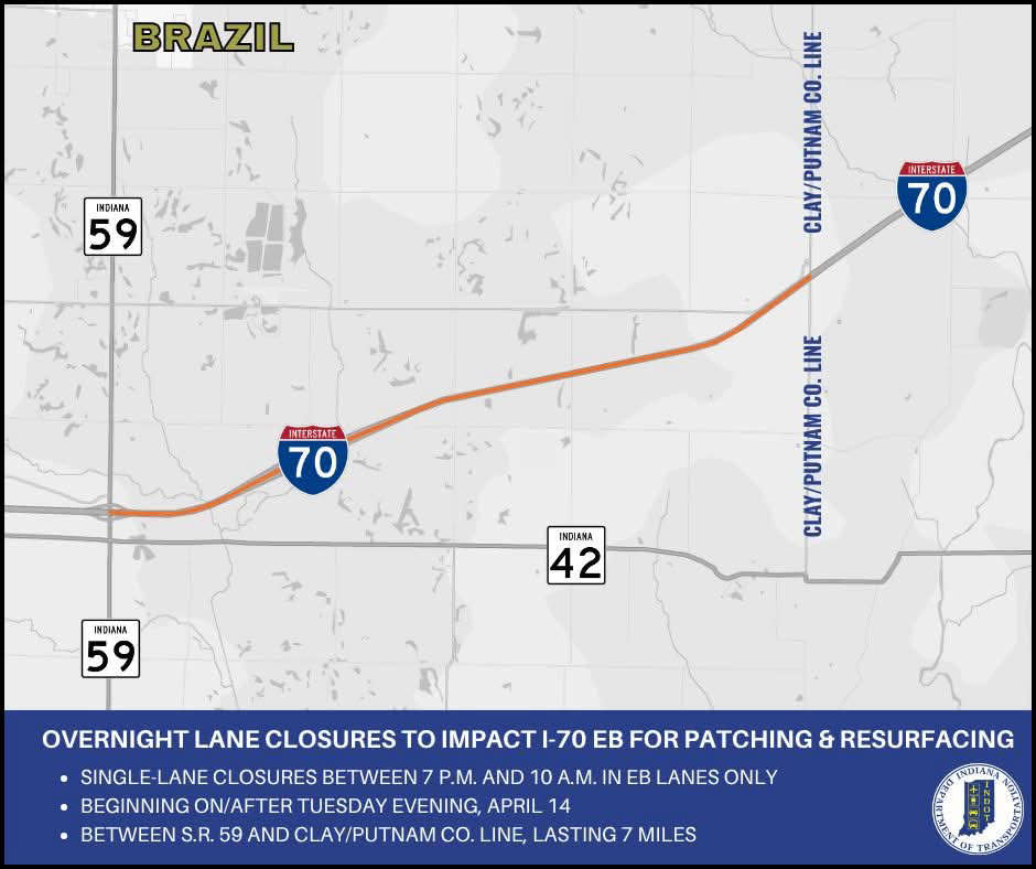 Overnight lane closures to impact I-70 eastbound in Clay County
 Crabgrass Control
 Putnamville Correctional Facility employee accused of smuggling drugs