
Additional concerns for area flooding come with the threat posed by the latest forecast.
A Flood Watch is in effect from the National Weather Service through 2 a.m. Wednesday. Meanwhile, another round of thunderstorms is expected tonight. Flooding and damaging winds appear to be the primary threats.
The additional issue is the Monday temperatures. Heat indices in the mid-90s to near 100 degrees this afternoon.
There is a chance for additional thunderstorms on Tuesday.
Fulton County Emergency Management is advising residents that rivers are coming out of their banks, along with usual flood areas.
The Highway Department has a load of sand at the Manitou boat ramp across from Dairy Queen on Highway 14 / 25.
Residents can pick up sandbags at the EMA office at 1728 E State Rd 14, Rochester, between 8 a.m.- 4 p.m. on Monday and Tuesday. An announcement will be made f there are extended dates and times for availability of those materials.
Please contact the office if you have further questions, 574-223-6611
 SW Parke School Board votes to close Montezuma Elementary
 Groundbreaking for $10B Meta data center campus at LEAP District
 Indiana to receive over $6M in EpiPen settlement
 Monrovia enters regional clash knowing what to expect
 Parke Heritage embraces 'underdog' role in upcoming regional
 Several contested races await Parke County voters
 ISP protect Hoosier kids from online predators
 Indiana BMV to offer Disability Blackout plate
 U.S. Postal Service to observe Presidents Day, Feb. 16
 Lucas Oil named title partner of 500 Festival Parade
 Applications open for new United Way of Central Indiana initiative to build community solutions
 Utilities District of Western Indiana REMC announces increases over next three years
 Fountain County man arrested on sex crime charges, Parke County investigation remains
 Friday is National Wear Red Day
 Vermillion County DCS worker facing felonies
 One week left to file for office in Indiana
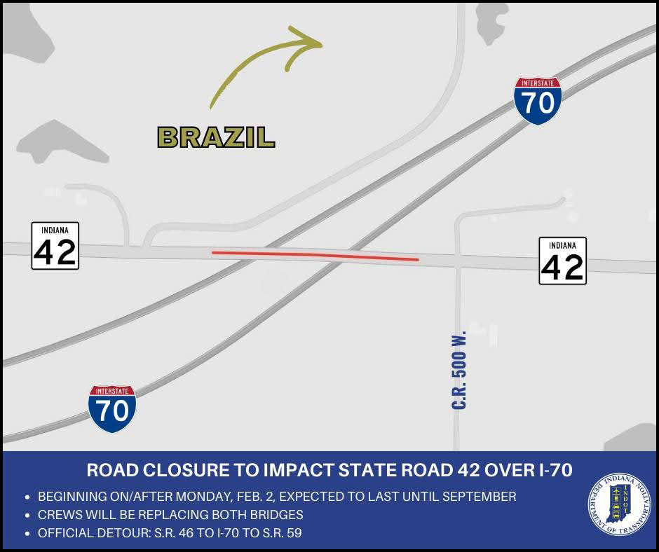 Bridge closures to impact State Road 42 over I-70 in Clay County