
The Indiana Department of Transportation is prepared for severe storms, heavy rain, and widespread flooding expected to move across Indiana starting this afternoon and evening.
As of Wednesday morning, the National Weather Service (NWS) has issued flood watches for all Indiana counties south of a line extending from Terre Haute to Indianapolis, and Muncie. NWS is calling for potential double-digit rainfall totals in parts of the state, primarily in southern Indiana. Significant flash and river flooding is likely in these areas. Severe storms with damaging winds, hail, and possible tornadoes are anticipated Wednesday afternoon and evening, followed by widespread heavy rain and additional storms through the weekend.
INDOT operations crews are clearing drains and preparing equipment to close flooded state roads as conditions dictate. Personnel will be on standby throughout the event to address roadway issues that may arise.
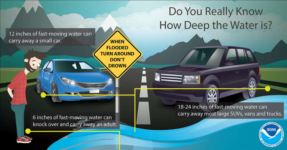
Drivers are urged to follow “road closed” signs and barricades to avoid becoming stranded in flood waters. It is never safe to drive around barricades through high water – remember to Turn Around, Don’t Drown. Downed trees and power lines will also be possible due to heavily saturated ground and high winds.
 Bremen residents urge County Commissioners to halt proposed Thermal Energy Plant, protect farmland
 Marshall County Recycle Depot diverts 316 Tons of Debris from landfills in 2025
 Argos teen arrested on domestic battery charges following Sunday altercation in Plymouth
 County Commissioners accept CCMG paving bid, discuss flooded roadways and Michigan Road bridge project
 Dyer woman arrested on drug and OWI charges following traffic stop in Plymouth
 INDOT marks official start of 2026 construction and maintenance season, urges importance of driving safely in work zones
 Nearly 30 items recalled in March: Attorney General Todd Rokita alerts Hoosiers to hazardous products
 Town of Culver seeking applicants for seasonal street department positions