

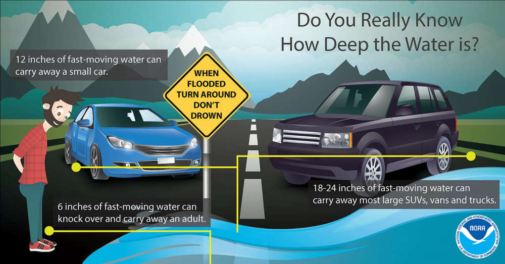
The Indiana Department of Transportation is prepared for severe storms, heavy rain, and widespread flooding expected to move across Indiana starting this afternoon and evening.
As of Wednesday morning, the National Weather Service (NWS) has issued flood watches for all Indiana counties south of a line extending from Terre Haute to Indianapolis, and Muncie. NWS is calling for potential double-digit rainfall totals in parts of the state, primarily in southern Indiana. Significant flash and river flooding is likely in these areas. Severe storms with damaging winds, hail, and possible tornadoes are anticipated Wednesday afternoon and evening, followed by widespread heavy rain and additional storms through the weekend.
INDOT operations crews are clearing drains and preparing equipment to close flooded state roads as conditions dictate. Personnel will be on standby throughout the event to address roadway issues that may arise.
Drivers are urged to follow “road closed” signs and barricades to avoid becoming stranded in flood waters. It is never safe to drive around barricades through high water – remember to Turn Around, Don’t Drown. Downed trees and power lines will also be possible due to heavily saturated ground and high winds.
 Kewanna Neighbor Day kicks off fun before annual fireworks July 3
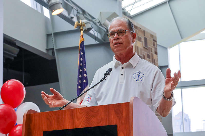
 Indiana Gov. Braun declares state of disaster emergency for 63 Indiana counties
 Longtime Argos educator, community leader Gene Cooper passed away
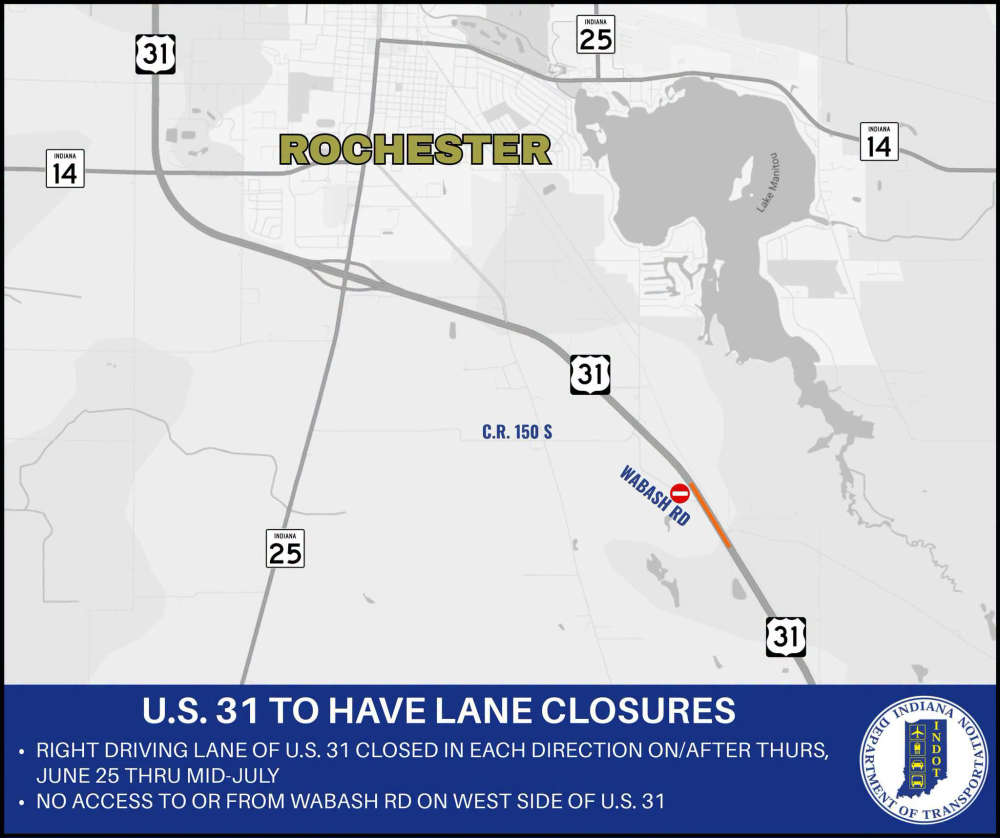 INDOT project to close section of U.S. 31 in Fulton County
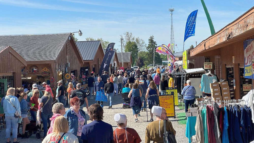 Shipshewana Flea Market hosts special weekend market June 19-20
 Gov. Braun unveils Indiana’s exhibit for the National Mall during The Great American State Fair
 North Judson man arrested after alleged violent burglary in Knox