Last night's snowfall outdid expectations, but we aren't done yet. The real stuff starts later today, upgraded the Winter Storm Watch into a Warning running through 7 PM Monday.
The National Weather Service predicts lake effect snow bands over the next 36 hours.
The updated snowfall map has most of Marshall County receiving 4-8" of new snowfall after what we already received last night.
Marshall County Emergency Management Agency Director Jack Garner will be keeping a close eye on the roads. Drivers should expect hazardous travel conditions, especially during periods of high snowfall rates.
 Education Union for ISTA staff files unfair labor charges
 People urged to take precautions against tick-borne disease as risk increases with warmer weather
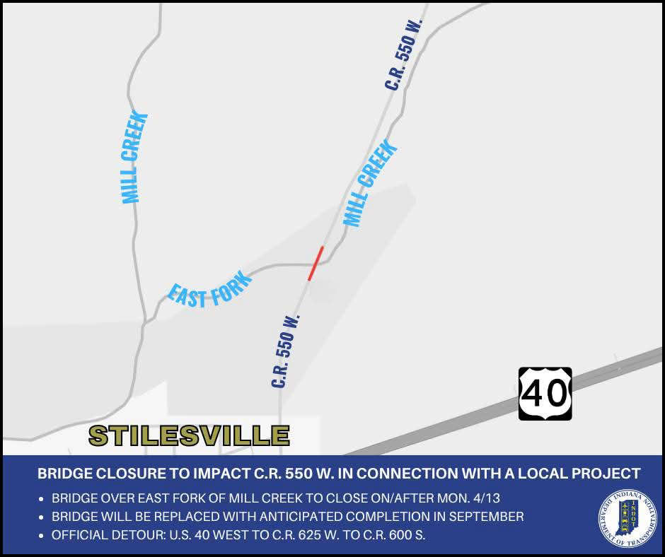 County Road 550 W. to close near Stilesville in connection with a local project
 Hoosiers may qualify for free well water testing
 FBI joins search for missing Owen County woman
 Archival Crawl hosted by Putnam Co. Public Library, Depauw and Putnam Co. Museum
 Attorney General vows to protect Hoosiers from gas price gouging during temporary gas tax suspension
 Elevated fire weather risk in Central Indiana