


The National Weather Service In Northern Indiana is advising of the risk for strong to severe thunderstorms mainly late this morning into the afternoon hours for locations along and south of US-30. The main concern will be damaging winds along with locally heavy rain (isolated tornado?). Wind gusts of 35 to 40 mph will be common outside any thunderstorms through this evening. Heavy rain will continue to fall.
Confidence in an isolated tornado threat remains low but there is still a possibility.
THREAT: Embedded thunderstorms with strong gusty winds of 35-40 mph. Localized flooding may occur in low-lying areas and areas susceptible to flooding during heavy rains. Ponding on road surfaces. An isolated tornado threat is possible.
IMPACT: Strong winds may cause damage to trees and could result in damage to power lines leading to power outages. Ponding on road surfaces may make driving hazardous.
PREPAREDNESS ACTIONS: Remain weather aware today and be ready to take action should severe weather threaten. If you live in an area that is prone to flooding, monitor conditions and be prepared to move to a safer location if necessary. Never drive through high water on a road.
Remember: Tornadoes can occur at any time of the year.
 Indiana AG reminds Hoosiers to be alert to signs of human trafficking
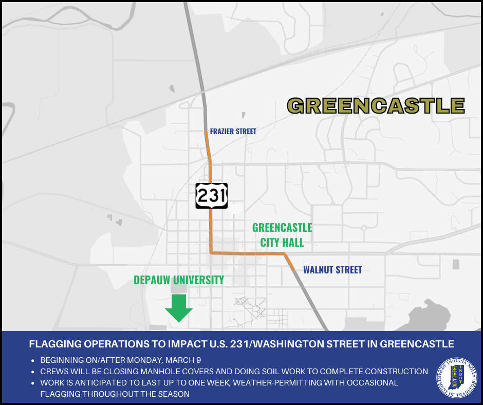 Intermittent flagging to impact U.S. 231 (Washington Street) in Greencastle
 Fuller Center seeks applicants for Greencastle home build
 Red Cross seeks donations to curb severe blood shortage
 Greencastle - Parke Heritage again, South Putnam vs Southmont on GIANT fm Sports
 Putnam County Friends of the NRA Banquet set for March
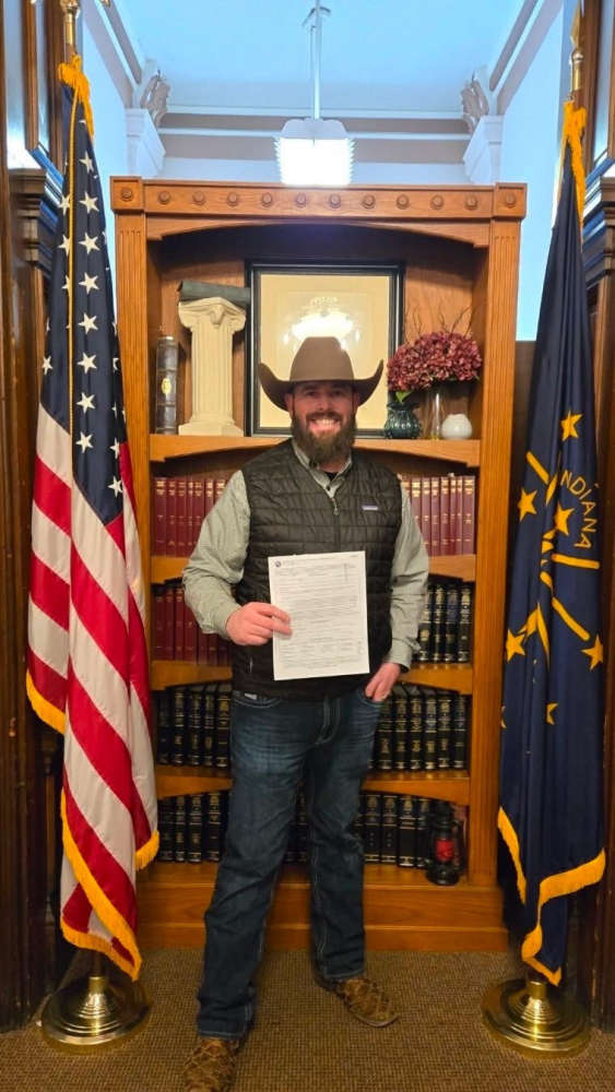 Cooper ready to run for Statehouse seat
 Fidler ready to represent on Putnam County Council