
closed
The National Weather Service (NWS) says a Flood Watch remains in effect for the entire WAKO listening area through the remainder of Tuesday. There is the possibility of strong severe thunderstorm activity in the region with forecasts of perhaps 2 inches or more of rain forecast. Excessive runoff from this amount of rain may result in river, creek, stream and other low-lying locations flooding. Heavy rainfall late Monday night into Tuesday morning across the region will also added to the potential of flooding.
 Owen Valley HS receives FEMA grant for repair from 2025 Spring storms
 One week left to file for office in Indiana
 History of Cloverdale – Talk at Putnam County Museum
 “Exploring 4-H” for Grade 2 Kicks off in February
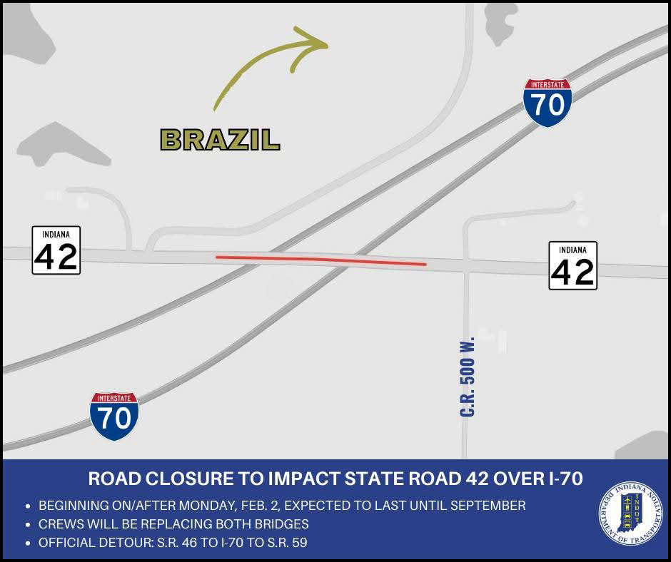 Bridge closures to impact State Road 42 over I-70 in Clay County
 South Putnam's Burgess leaves the Nest
 LEGO® Fans Food Drive
 Road renaming resolution co-authored by Criswell to honor Bobby Knight passes House